| Robert Louis Stevenson State Park | |
|---|---|
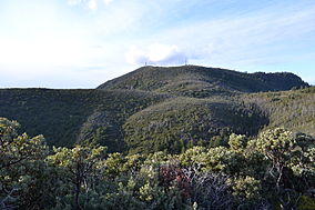
 One of the peaks of Mount Saint Helena | |
| Location | Sonoma and Napa counties, California |
| Nearest city | Calistoga, California |
| Coordinates | 38°39′12″N 122°36′12″W / 38.653416°N 122.603406°W |
| Governing body | State of California |
| Reference no. | 710[1] |
Robert Louis Stevenson State Park is a California state park, located in Sonoma, Lake and Napa counties. The park offers a 5-mile (8 km) hike to the summit of Mount Saint Helena from which much of the Bay Area can be seen. On clear days it is possible to see the peak of Mount Shasta, 192 miles (310 km) distant.
- ^ "Robert Louis Stevenson State Park". Office of Historic Preservation, California State Parks. Retrieved October 10, 2012.

