| Rock River | |
|---|---|
 | |
| Location | |
| Country | United States |
| State | Iowa, Minnesota |
| District | Sioux County, Iowa, Lyon County, Iowa, Rock County, Minnesota, Pipestone County, Minnesota |
| Physical characteristics | |
| Source | |
| • coordinates | 44°08′13″N 96°07′23″W / 44.1369°N 96.1231°W[1] |
| Mouth | Big Sioux River |
• coordinates | 43°04′58″N 96°27′16″W / 43.0827°N 96.4545°W[1] |
• elevation | 1,168[1] ft (356 m) |
| Discharge | |
| • location | Rock Valley, Iowa |
| • average | 610 cu/ft. per sec.[2] |
| Basin features | |
| Tributaries | |
| • left | Champepadan Creek |
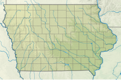
The Rock River is a tributary of the Big Sioux River, about 144 miles (232 km) long,[3] in southwestern Minnesota and northwestern Iowa in the United States. Via the Big Sioux and Missouri rivers, it is part of the watershed of the Mississippi River. The river's name comes from a prominent rocky outcrop about 175 feet high (designated "The Rock" on Joseph Nicollet's 1843 map of the area) of reddish-gray Sioux Quartzite, about 3 miles (5 km) north of Luverne.[4] The outcrop of quartzite is contained in Minnesota's Blue Mounds State Park.
- ^ a b c U.S. Geological Survey Geographic Names Information System: Rock River (Big Sioux River tributary)
- ^ "Water Data". USGS.
- ^ U.S. Geological Survey. National Hydrography Dataset high-resolution flowline data. The National Map, accessed March 30, 2011
- ^ Upham, Warren (1920). Minnesota Geographic Names. Minnesota Historical Society. p. 466. Retrieved 30 November 2019.
