Rocky Ridge, Utah | |
|---|---|
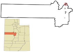
 Location of Rocky Ridge within Juab County and the state of Utah | |
| Coordinates: 39°55′30″N 111°49′35″W / 39.92500°N 111.82639°W | |
| Country | United States |
| State | Utah |
| County | Juab |
| Incorporated | January 1, 1998 |
| Area | |
| • Total | 1.71 sq mi (4.44 km2) |
| • Land | 1.71 sq mi (4.44 km2) |
| • Water | 0.00 sq mi (0.00 km2) |
| Elevation | 4,951 ft (1,509 m) |
| Population (2020) | |
| • Total | 848 |
| • Density | 500.58/sq mi (193.32/km2) |
| Time zone | UTC-7 (Mountain (MST)) |
| • Summer (DST) | UTC-6 (MDT) |
| ZIP Code | 84645 |
| FIPS code | 49-64590[3] |
| GNIS feature ID | 2412568[2] |
| Website | www |
Rocky Ridge is a town on the northeastern edge of Juab County, Utah, United States.[2][4] As of the 2010 census it had a population of 733,[5] and in 2018 the estimated population was 833.[6]
The town is located on the northern edge of the Juab Valley in the eastern foothills of the Wasatch Range, but entirely west of Interstate 15 (I‑15).[7] It is part of the Provo–Orem, Utah Metropolitan Statistical Area.
While there is a "Rocky Ridge"[8] and a "Rocky Ridge Canyon"[9] in northeastern Juab County (both located east of the city of Nephi, approximately 16 miles [26 km] south‑southeast of the community), the town was named for "the rocks, in a bountiful array of types and colors, strewn plentifully across the surrounding ridges separating Juab and Utah counties," according to the town website.[10]
- ^ "2019 U.S. Gazetteer Files". United States Census Bureau. Retrieved August 7, 2020.
- ^ a b c U.S. Geological Survey Geographic Names Information System: Rocky Ridge, Utah
- ^ Cite error: The named reference
censuswas invoked but never defined (see the help page). - ^ "Rocky Ridge, Utah" (Map). Google Maps. Retrieved February 23, 2018.
- ^ "Geographic Identifiers: 2010 Demographic Profile Data (G001): Rocky Ridge town, Utah". U.S. Census Bureau, American Factfinder. Retrieved December 28, 2018.[dead link]
- ^ "Population and Housing Unit Estimates". Retrieved June 4, 2019.
- ^ "MyTopo Maps - Rocky Ridge Town, UT, USA" (Map). mytopo.com. Trimble Navigation, Ltd. Retrieved February 22, 2018. Note: While the town is not labeled on the map, the search for "Rocky Ridge Town, UT, USA" centers on the location of the town.
- ^ "Rocky Ridge". Geographic Names Information System. United States Geological Survey, United States Department of the Interior.
- ^ "Rocky Ridge Canyon". Geographic Names Information System. United States Geological Survey, United States Department of the Interior.
- ^ "About Us". rockyridgetown.com. Retrieved February 23, 2018.