Rondo | |
|---|---|
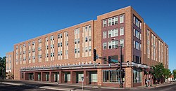
 Rondo Community Outreach Library, 2016 | |
 Center of Rondo in Saint Paul | |
| Coordinates: 44.951389, -93.12638944°57′05″N 93°07′35″W / 44.95139°N 93.12639°W | |
| Country | United States |
| State | Minnesota |
| County | Ramsey |
| City | Saint Paul |
| Time zone | UTC-6 (CST) |
| • Summer (DST) | UTC-5 (CDT) |
The Rondo neighborhood, or simply Rondo, is located within the officially designated Summit-University district in Saint Paul, Minnesota. The boundaries of the historically black neighborhood are sometimes referred to as Old Rondo. For much of the 20th century, Rondo was an important cultural and residential center of the black community in the Minneapolis–Saint Paul metropolitan region. The core of Old Rondo was demolished between 1956 and 1968, to make way for the construction of the Interstate 94 freeway. At least 650 families were displaced from the neighborhood, as well as many businesses and community locations. The neighborhood, although scarred by highway construction, remained a notable area in Saint Paul with a strong sense of cultural identity. Popular media and historians have the explored the impacts of highway construction and gentrification on Rondo residents past and present. In the 2000s, residents and public officials have discussed ways to reconnect the former community.