| Roper | |
|---|---|
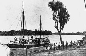
 The Goodwill on the Roper River | |
Location of the Roper River mouth in the Northern Territory | |
| Native name | Ropa Riba (Australian Kriol) |
| Location | |
| Country | Australia |
| Territory | Northern Territory |
| Physical characteristics | |
| Source confluence | Waterhouse River and Roper Creek |
| • location | east of Mataranka |
| • coordinates | 14°55′58″S 133°08′59″E / 14.93278°S 133.14972°E |
| • elevation | 126 m (413 ft) |
| Mouth | Limmen Bight |
• location | Gulf of Carpentaria |
• coordinates | 14°42′40″S 135°19′42″E / 14.71111°S 135.32833°E |
• elevation | 0 m (0 ft) |
| Length | 400 km (250 mi)[1] |
| Basin size | 81,794 km2 (31,581 sq mi)[2][3] |
| Discharge | |
| • location | Limmen Bight (near mouth) |
| • average | 5,540,000 ML/a (176 m3/s)[4] to (Period: 1971–2000)296.9 m3/s (10,480 cu ft/s)[5] |
| Discharge | |
| • location | Ngukurr (105 rkm; Basin size: 69,553.2 km2 (26,854.6 sq mi) |
| • average | (Period: 1971–2000)253.5 m3/s (8,950 cu ft/s)[5] |
| Discharge | |
| • location | Red Rock (161 rkm; Basin size: 47,400 km2 (18,300 sq mi) |
| • average | (Period: 1966–1999)88.8 m3/s (3,140 cu ft/s)[2] to (Period: 1971–2000)106 m3/s (3,700 cu ft/s)[5] |
| • minimum | 0 m3/s (0 cu ft/s)[2] |
| • maximum | 1,395 m3/s (49,300 cu ft/s)[2] |
| Discharge | |
| • location | Mataranka (Confluence of Waterhouse River and Roper Creek, 400 rkm; Basin size: 5,950.6 km2 (2,297.5 sq mi) |
| • average | (Period: 1961–1999)20.5 m3/s (720 cu ft/s)[2] to (Period: 1971–2000)22.2 m3/s (780 cu ft/s)[5] |
| • minimum | 0.7 m3/s (25 cu ft/s)[2] |
| • maximum | 182.5 m3/s (6,440 cu ft/s)[2] |
| Basin features | |
| River system | Roper River |
| Tributaries | |
| • left | Waterhouse, Chambers, Maiwok Creek, Flying Fox Creek, Jalboi, Wilton, Phelp |
| • right | Roper Creek, Elsey Creek, Strandways, Hodgson, Mountain Creek |
| National park | Elsey National Park |
| [6] | |
The Roper River is a large perennial river located in the Katherine region of the Northern Territory of Australia.
- ^ "Roper River".
- ^ a b c d e f g Cite error: The named reference
:0was invoked but never defined (see the help page). - ^ "Roper River Catchment" (PDF).
- ^ "Basin & Surface Water Management Area: Roper River".
- ^ a b c d "Darwin-Arnhem".
- ^ "Map of Roper River, NT". Bonzle Digital Atlas of Australia. Retrieved 11 May 2015.
