Roseville, Ohio | |
|---|---|
 The C.W. Ransbottom House, a historic site on Washington Street | |
 Location of Roseville, Ohio | |
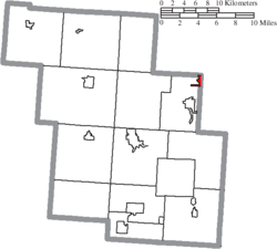
 Location of Roseville in Perry County | |
| Coordinates: 39°48′23″N 82°04′33″W / 39.80639°N 82.07583°W | |
| Country | United States |
| State | Ohio |
| Counties | Perry, Muskingum |
| Townships | Harrison, Clay |
| Area | |
| • Total | 0.69 sq mi (1.79 km2) |
| • Land | 0.69 sq mi (1.78 km2) |
| • Water | 0.01 sq mi (0.01 km2) |
| Elevation | 748 ft (228 m) |
| Population (2020) | |
| • Total | 1,746 |
| • Density | 2,541.48/sq mi (980.62/km2) |
| Time zone | UTC-5 (Eastern (EST)) |
| • Summer (DST) | UTC-4 (EDT) |
| ZIP code | 43777 |
| Area code | 740 |
| FIPS code | 39-68560[3] |
| GNIS feature ID | 2399124[2] |
Roseville is a village in Muskingum and Perry counties in the U.S. state of Ohio, along Moxahala Creek. The population was 1,746 at the 2020 census. It is part of the Zanesville micropolitan area. Roseville is served by a branch of the Muskingum County Library System.[4]
- ^ "ArcGIS REST Services Directory". United States Census Bureau. Retrieved September 20, 2022.
- ^ a b U.S. Geological Survey Geographic Names Information System: Roseville, Ohio
- ^ "U.S. Census website". United States Census Bureau. Retrieved January 31, 2008.
- ^ "Locations". Muskingum County Library System. Retrieved March 1, 2018.