| Rosthwaite Fell | |
|---|---|
 Rosthwaite Cam from Bessyboot with Tarn at Leaves in between | |
| Highest point | |
| Elevation | 612 m (2,008 ft) |
| Prominence | c. 15 m (50 ft) |
| Parent peak | Dovenest Top |
| Listing | Wainwright (Bessyboot) |
| Coordinates | 54°29′46″N 3°09′06″W / 54.49603°N 3.15176°W |
| Geography | |
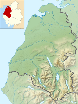
Location in the Lake District National Park | |
| Location | Cumbria, England |
| Parent range | Lake District, Southern Fells |
| OS grid | NY255118 |
| Topo map | OS Landrangers 89,90, Explorer OL4 |

Rosthwaite Fell is a fell in the English Lake District. It is situated some 12 kilometres (7+1⁄2 miles) due south of Keswick and 2 kilometres (1+1⁄4 miles) south of the village of Rosthwaite in Borrowdale.
Rosthwaite Fell also has loose connections to the Scafell group of fells. The fells name derives from the Old Norse language and means “The peak above the clearing with a heap of stones” with “hreysi” meaning a heap of stones and “thveit” meaning a clearing.

