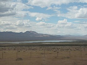
| Rye Patch State Recreation Area | |
|---|---|
 | |
| Location | Pershing County, Nevada, United States |
| Nearest city | Lovelock, Nevada |
| Coordinates | 40°41′53″N 118°17′14″W / 40.69806°N 118.28722°W[1] |
| Area | 2,448.99 acres (991.07 ha)[2] |
| Elevation | 4,137 ft (1,261 m)[1] |
| Established | 1971 |
| Administered by | Nevada Division of State Parks |
| Visitors | 25,556 vehicles (in 2017)[3] |
| Designation | Nevada state park |
| Website | Official website |
Rye Patch State Recreation Area is a 2,400-acre (970 ha) state park unit of Nevada, United States, adjoining Rye Patch Reservoir, an 11,000-acre (4,500 ha) impoundment on the Humboldt River, and the smaller Pitt-Taylor Reservoirs. The recreation area is located at the end of State Route 401 (Rye Patch Road), which connects to Interstate 80/U.S. Route 95 about 22 miles (35 km) northeast of Lovelock.[4]
- ^ a b "Rye Patch Reservoir". Geographic Names Information System. United States Geological Survey, United States Department of the Interior.
- ^ Cite error: The named reference
statelandswas invoked but never defined (see the help page). - ^ "Division of State Parks Performance Audit" (PDF). Nevada Legislature. 2018.
- ^ Cite error: The named reference
planwas invoked but never defined (see the help page).
