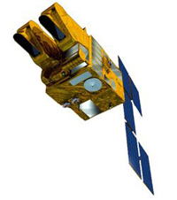

SPOT (French: Satellite Pour l’Observation de la Terre,[1] lit. "Satellite for observation of Earth") is a commercial high-resolution optical Earth imaging satellite system operating from space. It is run by Spot Image, based in Toulouse, France. It was initiated by the CNES (Centre national d'études spatiales – the French space agency) in the 1970s and was developed in association with the SSTC (Belgian scientific, technical and cultural services) and the Swedish National Space Board (SNSB). It has been designed to improve the knowledge and management of the Earth by exploring the Earth's resources, detecting and forecasting phenomena involving climatology and oceanography, and monitoring human activities and natural phenomena. The SPOT system includes a series of satellites and ground control resources for satellite control and programming, image production, and distribution. Earlier satellites were launched using the European Space Agency's Ariane 2, 3, and 4 rockets, while SPOT 6 and SPOT 7 were launched by the Indian PSLV.[2][3]
- ^ "SPOT - Looking Down on Earth". CNES. Archived from the original on 6 October 2013. Retrieved 19 August 2013.
- ^ "ISRO prepares for historic 100th mission". Times of India. 22 August 2012. Retrieved 2014-09-21.
- ^ "Isro's PSLV-C23 lifts off with five foreign satellites". Times of India. 30 June 2014. Retrieved 2014-09-21.