Sa'sa'
سعسع | |
|---|---|
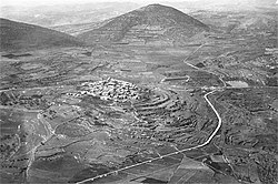
 Sa'sa', 1939 | |
| Etymology: from personal name[1] | |
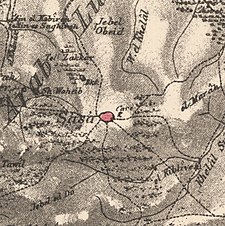
A series of historical maps of the area around Sa'sa' (click the buttons) | |
Location within Mandatory Palestine | |
| Coordinates: 33°01′43″N 35°23′40″E / 33.02861°N 35.39444°E | |
| Palestine grid | 187/270 |
| Geopolitical entity | Mandatory Palestine |
| Subdistrict | Safad |
| Date of depopulation | 30 October 1948[4] |
| Area | |
| • Total | 14,796 dunams (14.796 km2 or 5.713 sq mi) |
| Population (1945) | |
| • Total | 1,130[2][3] |
| Cause(s) of depopulation | Military assault by Yishuv forces |
| Secondary cause | Expulsion by Yishuv forces |
| Current Localities | Sasa[5] |
Sa'sa' (Arabic: سعسع, Hebrew: סעסע) was a Palestinian village, located 12 kilometres northwest of Safed, that was depopulated by Israeli forces during the 1948 Arab-Israeli war. The village suffered two massacres committed by Haganah forces: one in mid-February 1948 and the other at the end of October the same year.[6][7][8] Its place has been taken since 1949 by Sasa, an Israeli kibbutz.
- ^ Palmer, 1881, p. 93, see also p. 70
- ^ Department of Statistics, 1945, p. 11
- ^ a b Government of Palestine, Department of Statistics. Village Statistics, April, 1945. Quoted in Hadawi, 1970, p. 71
- ^ Morris, 2004, p. xvi, village #60. Also gives causes of depopulation.
- ^ Morris, 2004, p. xxi, Settlement #51, established January 1949.
- ^ Khalidi, 1992, p. 495
- ^ Pappé, 2006, p. 77 ff.
- ^ Benvenisti, 2000, p. 153


