| Saale | |
|---|---|
 The Saale valley near Hof | |
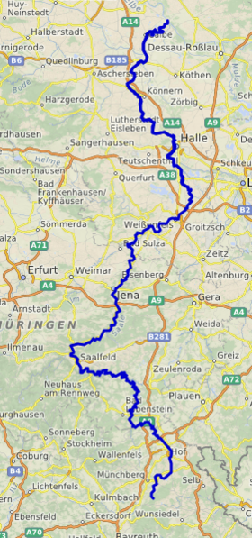
 The Saale has its source in the Fichtel Mountains in northeastern Franconia (Bavaria) and flows into the Elbe at Barby, Saxony-Anhalt. | |
| Location | |
| Country | Germany |
| States | |
| Reference no. | DE: 56 |
| Physical characteristics | |
| Source | |
| • location | near Zell im Fichtelgebirge |
| • coordinates | 50°07′14″N 11°49′50″E / 50.12056°N 11.83056°E |
| • elevation | 728 m above sea level (NN) |
| Mouth | |
• location | near Barby into the Elbe |
• coordinates | 51°57′17″N 11°54′50″E / 51.95472°N 11.91389°E |
• elevation | 49.5 m above sea level (NN) |
| Length | 413 km (257 mi)[1] |
| Basin size | 24,167 km2 (9,331 sq mi)[1] |
| Discharge | |
| • average | 115 m3/s (4,100 cu ft/s) |
| Basin features | |
| Progression | Elbe→ North Sea |
| Landmarks |
|
| Tributaries | |
| • left | Schwarza, Ilm, Unstrut, Salza, Wipper, Bode |
| • right | White Elster, Orla, Southern and Northern Regnitz |
| Bridges | Saale bridge, Rudolphstein, Old Saale bridge, Jena-Burgau |
| Inland ports | Hafen Halle (Saale), Sophienhafen in Halle (Saale) |
| Navigable | From its mouth to Bad Dürrenberg; for Europa ships to Halle-Trotha[2] |
 | |
The Saale (German pronunciation: [ˈzaːlə] ), also known as the Saxon Saale (German: Sächsische Saale pronounced [ˈzɛksɪʃə ˈzaːlə] ) and Thuringian Saale (German: Thüringische Saale), is a river in Germany and a left-bank tributary of the Elbe. It is not to be confused with the smaller Franconian Saale, a right-bank tributary of the Main, or the Saale in Lower Saxony, a tributary of the Leine.
- ^ a b Michael Bergemann (1 July 2015). "Gesamtliste der Fließgewässer im Elbeeinzugsgebiet" (PDF; 791 kB) (in German). Arbeitsgemeinschaft für die Reinhaltung der Elbe. Retrieved 21 March 2018.
- ^ "Federal Water and Navigation Authority". Archived from the original on 13 February 2010. Retrieved 9 May 2010.