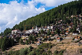
Saint-Luc | |
|---|---|
 General view of Saint-Luc | |
| Coordinates: 46°13′N 7°36′E / 46.217°N 7.600°E | |
| Country | Switzerland |
| Canton | Valais |
| District | Sierre |
| Area | |
| • Total | 31.9 km2 (12.3 sq mi) |
| Elevation | 1,655 m (5,430 ft) |
| Population (December 2008) | |
| • Total | 312 |
| • Density | 9.8/km2 (25/sq mi) |
| Time zone | UTC+01:00 (Central European Time) |
| • Summer (DST) | UTC+02:00 (Central European Summer Time) |
| Postal code(s) | 3961 |
| SFOS number | 6247 |
| ISO 3166 code | CH-VS |
| Website | www SFSO statistics |
Saint-Luc (French pronunciation: [sɛ̃ lyk] ) is a village in the district of Sierre in the Swiss canton of Valais. An independent municipality before, it merged on 1 January 2009 with neighboring Ayer, Chandolin, Grimentz, Saint Jean and Vissoie to form the municipality of Anniviers.[1]
- ^ Amtliches Gemeindeverzeichnis der Schweiz published by the Swiss Federal Statistical Office (in German) accessed 19 July 2011


