Saline County | |
|---|---|
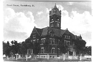
 Former Saline County Courthouse in Harrisburg | |
 Location within the U.S. state of Illinois | |
 Illinois's location within the U.S. | |
| Coordinates: 37°45′N 88°32′W / 37.75°N 88.54°W | |
| Country | |
| State | |
| Founded | 1847 |
| Named for | Saline River |
| Seat | Harrisburg |
| Largest city | Harrisburg |
| Area | |
• Total | 387 sq mi (1,000 km2) |
| • Land | 380 sq mi (1,000 km2) |
| • Water | 7.0 sq mi (18 km2) 1.8% |
| Population (2020) | |
• Total | 23,768 |
| • Density | 61/sq mi (24/km2) |
| Time zone | UTC−6 (Central) |
| • Summer (DST) | UTC−5 (CDT) |
| Congressional district | 12th |
| Website | www |
Saline County is a county in Southern Illinois. At the 2020 census, it had a population of 23,768.[1] The largest city and county seat is Harrisburg.[2] This area of Southern Illinois is known locally as "Little Egypt".
Three major towns in Saline County are connected by U.S. Route 45, and formerly by the now-abandoned Cairo and Vincennes/Big Four/New York Central Line, from north to south: Eldorado, Harrisburg, and Carrier Mills.
- ^ "State & County QuickFacts". United States Census Bureau. Archived from the original on June 7, 2011. Retrieved July 8, 2014.
- ^ "Find a County". National Association of Counties. Retrieved June 7, 2011.
