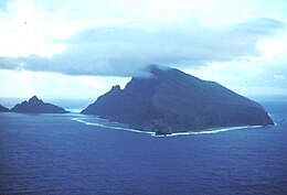
Native name: Motu o Sāmoa | |
|---|---|
 | |
 | |
| Geography | |
| Location | Polynesia |
| Area | 3,030 km2 (1,170 sq mi) |
| Highest elevation | 1,858 m (6096 ft) |
| Highest point | Mauga Silisili |
| Administration | |
| Largest settlement | Apia (pop. 38,800) |
| Largest settlement | Tafuna (pop. 9,756) |
| Demographics | |
| Population | 249,839 (2012) |
The Samoan Islands (Samoan: Motu o Sāmoa) are an archipelago covering 3,030 km2 (1,170 sq mi) in the central South Pacific, forming part of Polynesia and of the wider region of Oceania. Administratively, the archipelago comprises all of the Independent State of Samoa and most of American Samoa (apart from Swains Island, which is geographically part of the Tokelau Islands). The land masses of the two Samoan jurisdictions are separated by 64 km (40 mi) of ocean at their closest points.
The population of the Samoan Islands is approximately 250,000.[1] The inhabitants have in common the Samoan language, a culture known as fa'a Samoa, and an indigenous form of governance called fa'amatai.[2] Samoans are one of the largest Polynesian populations in the world, and most are of exclusively Samoan ancestry.[3]
The oldest known evidence of human activity in the Samoan Islands dates to around 1050 BCE. It comes from a Lapita site at Mulifanua wharf on Upolu island.[4] In 1768, the eastern islands were visited by the French explorer Bougainville, who named them the Navigator Islands. That name was used by missionaries until about 1845, and in official European dispatches until about 1870.[5]
- ^ "Cultures of Polynesia – Polynesian Cultural Center". polynesia.com. Retrieved 2 April 2018.
- ^ Fana'afi Le Tagaloa, Aiono (1986). "Western Samoa: the sacred covenant". Land Rights of Pacific Women. Institute of Pacific Studies of the University of the South Pacific. p. 103. ISBN 982-02-0012-1. Retrieved 17 April 2010.
- ^ Stanley, David (2004). Moon Handbooks: South Pacific. David Stanley. p. 500. ISBN 1-56691-411-6. Retrieved 20 June 2010.
Samoans full blooded Polynesian percentage.
- ^ "New Information for the Ferry Berth Site, Mulifanua, Western Samoa by Roger C. Green & Helen M. Leach". Journal of the Polynesian Society. 98 (3): 1989. Retrieved 22 April 2010.
- ^ Masterman, Sylvia (1934). The Origins of International Rivalry in Samoa: 1845–1884. George Allen and Unwin Ltd, London. p. 14.