San Joaquin, California | |
|---|---|
| City of San Joaquin | |
 Main Street in San Joaquin | |
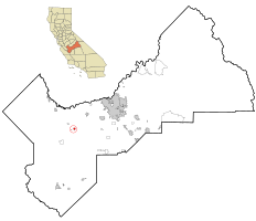
 Location in Fresno County and the state of California | |
| Coordinates: 36°36′24″N 120°11′21″W / 36.60667°N 120.18917°W | |
| Country | United States |
| State | California |
| County | Fresno |
| Incorporated | February 14, 1920[1] |
| Named for | St. Joachim |
| Government | |
| • Type | Council–Manager |
| • Mayor | Julia Hernandez |
| • State Senator | Melissa Hurtado (D)[2] |
| • State Assembly | Joaquin Arambula (D)[3] |
| • U. S. Congress | Jim Costa (D)[4] |
| Area | |
| • Total | 1.20 sq mi (3.10 km2) |
| • Land | 1.20 sq mi (3.10 km2) |
| • Water | 0.00 sq mi (0.00 km2) 0% |
| Elevation | 174 ft (53 m) |
| Population | |
| • Total | 3,701 |
| • Density | 3,100/sq mi (1,200/km2) |
| Time zone | UTC-8 (PST) |
| • Summer (DST) | UTC-7 (PDT) |
| ZIP code | 93660 |
| Area code | 559 |
| FIPS code | 06-67126 |
| GNIS feature IDs | 277594, 2411789 |
| Website | www |
San Joaquin (Spanish: San Joaquín, meaning "St. Joachim") is a city in Fresno County, California, United States. The population was 4,001 at the 2010 census, up from 3,270 at the 2000 census. The nearest high school in the area is Tranquillity High School in Tranquillity. San Joaquin is located 11 miles (18 km) southwest of Kerman,[8] at an elevation of 174 feet (53 m).[6]
- ^ "California Cities by Incorporation Date". California Association of Local Agency Formation Commissions. Archived from the original (Word) on November 3, 2014. Retrieved April 6, 2013.
- ^ "Senators". State of California. Retrieved April 6, 2013.
- ^ "Members Assembly". State of California. Retrieved April 6, 2013.
- ^ "California's 21st Congressional District - Representatives & District Map". Civic Impulse, LLC. Retrieved April 6, 2013.
- ^ "2019 U.S. Gazetteer Files". United States Census Bureau. Retrieved July 1, 2020.
- ^ a b "San Joaquin". Geographic Names Information System. United States Geological Survey, United States Department of the Interior.
- ^ "US Census Bureau". www.census.gov. Retrieved August 21, 2024.
- ^ Durham, David L. (1998). California's Geographic Names: A Gazetteer of Historic and Modern Names of the State. Clovis, Calif.: Word Dancer Press. p. 1102. ISBN 1-884995-14-4.

