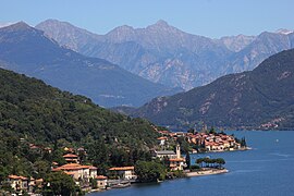
San Siro
San Sir (Lombard) | |
|---|---|
| Comune di San Siro | |
 | |
| Coordinates: 46°4′N 9°16′E / 46.067°N 9.267°E | |
| Country | Italy |
| Region | Lombardy |
| Province | Como (CO) |
| Government | |
| • Mayor | Nicola Mappa |
| Area | |
| • Total | 18.55 km2 (7.16 sq mi) |
| Elevation | 220 m (720 ft) |
| Population (31 December 2010)[2] | |
| • Total | 1,804 |
| • Density | 97/km2 (250/sq mi) |
| Demonym | Sansiresi |
| Time zone | UTC+1 (CET) |
| • Summer (DST) | UTC+2 (CEST) |
| Postal code | 22010 |
| Dialing code | 0344 |
| Website | Official website |
San Siro (Comasco: San Sir [ˌsãː ˈsiːr]) is a comune (municipality) in the Province of Como in the Italian region Lombardy, located on the west shore of Lake Como immediately north of Menaggio and south of Cremia.
The comune was formed on March 30, 2003, by the fusion of the former comuni of Sant'Abbondio and Santa Maria Rezzonico.
- ^ "Superficie di Comuni Province e Regioni italiane al 9 ottobre 2011". Italian National Institute of Statistics. Retrieved 16 March 2019.
- ^ All demographics and other statistics: Italian statistical institute Istat.


