This article needs additional citations for verification. (November 2011) |
Sancreed
| |
|---|---|
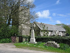
 Sancreed parish church | |
Location within Cornwall | |
| Population | 649 (2011 census including Brane and Catchall) |
| OS grid reference | SW418293 |
| Civil parish |
|
| Unitary authority | |
| Ceremonial county | |
| Region | |
| Country | England |
| Sovereign state | United Kingdom |
| Post town | Penzance |
| Postcode district | TR19, TR20 |
| Dialling code | 01736 |
| Police | Devon and Cornwall |
| Fire | Cornwall |
| Ambulance | South Western |
| UK Parliament | |
Sancreed (Cornish: Eglossankres) is a village and civil parish in Cornwall, England, United Kingdom, approximately three miles (5 km) west of Penzance.[1]
Sancreed civil parish encompasses the settlements of Bejouans, Bosvennen, Botreah, Drift, Sancreed Churchtown, Trenuggo, and Tregonnebris. It is bounded by St Just parish to the west, Madron parish to the northeast, and St Buryan and Paul parishes to the south. The parish comprises 4,608 acres (18.65 km2) of land including Drift Reservoir, which provides drinking water for the area.
- ^ Ordnance Survey: Landranger map sheet 203 Land's End ISBN 978-0-319-23148-7
