Sandi, Uttar Pradesh
Sandi Shantanupuri | |
|---|---|
Town | |
 Map of Sandi CD block | |
| Coordinates: 27°18′N 79°57′E / 27.3°N 79.95°E | |
| Country | |
| State | Uttar Pradesh |
| Division | Lucknow |
| District | Hardoi |
| Government | |
| • Type | Municipal Council |
| • Body | Sandi Municipal Council |
| • Municipal Chairperson | Ramji Gupta[1] (BSP) |
| • MLA | Prabhash Kumar (BJP) |
| Area | |
| • Total | 12.02 km2 (4.64 sq mi) |
| Elevation | 175 m (574 ft) |
| Population (2011) | |
| • Total | 26,007 |
| • Density | 2,200/km2 (5,600/sq mi) |
| Languages | |
| • Official | Awadhi, Hindi, Khariboli, Urdu |
| Time zone | UTC+5:30 (IST) |
| Vehicle registration | UP-30 |
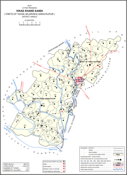
Sandi is a town and a nagar palika parishad in Bilgram tehsil of Hardoi district, Uttar Pradesh, India.[2] It is located on the left bank of the Garra river, on the road from Hardoi to Fatehgarh.[3] As of 2011, its population is 26,007, in 4,396 households.[2]
- ^ "2023 UP Municipal Election results". ECI Uttar Pradesh. Retrieved 22 May 2023.
- ^ a b c "Census of India 2011: Uttar Pradesh District Census Handbook - Hardoi, Part A (Village and Town Directory)" (PDF). Census 2011 India. pp. 32–34, 41, 231–55, 578–81, 589. Retrieved 31 May 2021.
- ^ Nevill, H.R. (1904). Hardoi - A Gazetteer. Allahabad: Government Press. pp. 242–5. Retrieved 31 May 2021.

