| Sandy Flat New South Wales | |
|---|---|
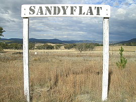
 Sandy Flat rail siding sign | |
| Coordinates | 29°15′S 151°59′E / 29.250°S 151.983°E |
| Population | 209 (2011 census)[1] |
| Postcode(s) | 2372 |
| Elevation | 805 m (2,641 ft) |
| Location |
|
| LGA(s) | Tenterfield Shire |
| County | Clive County |
| State electorate(s) | Lismore |
| Federal division(s) | New England |
Sandy Flat is a historic locality on the Northern Tablelands in the New England region of New South Wales, Australia. This locality is situated on New England Highway and the former Main North Railway line about 20 kilometres south of Tenterfield. At the 2011 census, Sandy Flat had a population of 209 people.[1]
Sandy Flat takes its name from a general description of the area. Nearby Bluff Rock is a commonly photographed landmark along the New England Highway.
- ^ a b Australian Bureau of Statistics (31 October 2012). "Sandy Flat (State Suburb)". 2011 Census QuickStats. Retrieved 10 April 2015.
