This article is written like a manual or guide. (April 2019) |
Sant Antoni de Portmany
San Antonio Abad | |
|---|---|
Town | |
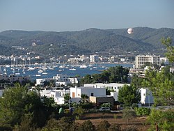
 Sant Antoni Bay | |
| Coordinates: 38°58′51″N 1°18′2″E / 38.98083°N 1.30056°E | |
| Country | Spain |
| Autonomous community | Balearic Islands |
| Province | Balearic Islands |
| Island | Ibiza |
| Government | |
| • Mayor | Marcos Serra Colomar (PP) |
| Area | |
| • Total | 127 km2 (49 sq mi) |
| Elevation | 31 m (102 ft) |
| Population (2012) | |
| • Total | 22,446 |
| • Density | 180/km2 (460/sq mi) |
| Time zone | UTC+1 (CET) |
| • Summer (DST) | UTC+2 (CEST (GMT +2)) |
| Postal code | 07820 |
| Area code | +34 (Spain) + 971 (Baleares) |
| Website | Town Hall |
Sant Antoni de Portmany (Balearic Catalan: [ˈsant ənˈtɔni ðə puɾˈmaɲ]; Spanish: San Antonio Abad),[1][2] or simply Sant Antoni (San Antonio), is a town on the western coast of Ibiza, the second-largest town and municipality on the island.[3] It is situated on Sant Antoni Bay on the west coast of the island, part of the Spain autonomous community of the Balearic Islands.
- ^ Tess Reidy in San Antonio, Ibiza. "Ibiza: 'Nothing is innocent and dealing is normal' | World news | The Observer". Theguardian.com. Retrieved 18 September 2013.
- ^ "BBC News - Holidaymaker Grant Weston from Pembroke dies in Ibiza fall". Bbc.co.uk. 14 August 2013. Retrieved 18 September 2013.
- ^ World's best clubbing destinations

