Santa Cruz | |
|---|---|
Barangay | |
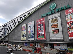
 Fisher Mall | |
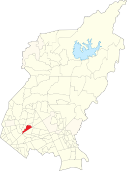
 Map of Quezon City showing Santa Cruz | |
 | |
| Coordinates: 14°38′5″N 121°1′4″E / 14.63472°N 121.01778°E | |
| Country | Philippines |
| Region | National Capital Region |
| City | Quezon City |
| District | 1st District of Quezon City |
| Government | |
| • Type | Barangay |
| • Barangay Chairman | Ernesto B. Baetiong Sr. |
| Time zone | UTC+8 (PST) |
| Zip Code | 1104 |
| Area code | 02 |
Santa Cruz often abbreviated as Sta. Cruz is a barangay located in the San Francisco Del Monte district of Quezon City with an approximate land area of 44 hectares bounded by South and West Triangles in the East, Quezon Avenue and Barangay Paligsahan in the South, Nayong Kanluran in the Northeast and Barangay Paltok in the North.
Neighboring barangays include Mariblo, Paraiso, Paltok, Talayan, Sto. Domingo, Paligsahan, West and South Triangles under the first and fourth Legislative districts in Quezon City, Metro Manila, Philippines.
Its barangay hall is located near Mariblo bridge, separating the area with Barangay Mariblo.
