Santa Isabel
Municipio Autónomo de Santa Isabel | |
|---|---|
Town and Municipality | |
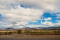
 Skyline of Jauca 2 barrio in Santa Isabel | |
| Nicknames: Tierra de Campeones, La Ciudad de los Potros Capital de la Agricultura | |
| Anthem: "En un pedazo del sur estás presente" | |
 Map of Puerto Rico highlighting Santa Isabel Municipality | |
| Coordinates: 17°57′58″N 66°24′18″W / 17.96611°N 66.40500°W | |
| Sovereign state | |
| Commonwealth | |
| Settled | 1801 |
| Founded | October 5, 1842 |
| Founded by | Don Juan de la Cruz, and Antonio Vélez |
| Named for | Saint Isabelle of France |
| Barrios | |
| Government | |
| • Mayor | Billy Burgos Santiago (PPD) |
| • Senatorial dist. | 6 - Guayama |
| • Representative dist. | 27 |
| Area | |
| • Total | 34.3 sq mi (88.9 km2) |
| Population (2020)[1] | |
| • Total | 20,281 |
| • Rank | 60th in Puerto Rico |
| • Density | 590/sq mi (230/km2) |
| Demonym | Santaisabelinos |
| Time zone | UTC−4 (AST) |
| ZIP Code | 00757 |
| Area code | 787/939 |
| Major routes | |
Santa Isabel (Spanish pronunciation: [ˈsantajsaˈβel]) is a town and municipality of Puerto Rico located in the southern coast of the island, south of Coamo; east of Juana Díaz; and west of Salinas. Santa Isabel is spread over 7 barrios and Santa Isabel Pueblo (the downtown area and the administrative center). It is the principal city of the Santa Isabel Micropolitan Statistical Area and is part of the Ponce-Yauco-Coamo Combined Statistical Area.
Santa Isabel is known as The Capital of Agriculture,[2] La Ciudad de los Potros ("City of Colts") due to the number of potreros (or racehorse stud farms) in the area.

