Satsumasendai
薩摩川内市 | |
|---|---|
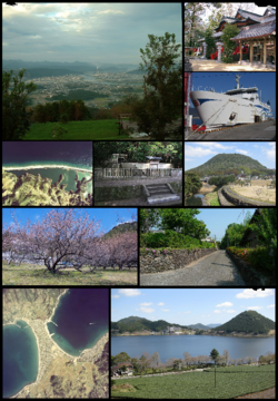
 From top to bottom, left to right: Niita Shrine, Kamikoshiki Island Nagame-no-hama , Iriki Fumoto, Imutaike, Panorama of Satsumasendai | |
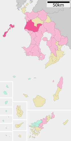
 Location of Satsumasendai in Kagoshima Prefecture | |
 | |
| Coordinates: 31°48′48″N 130°18′14″E / 31.81333°N 130.30389°E | |
| Country | Japan |
| Region | Kyushu |
| Prefecture | Kagoshima |
| Government | |
| • Mayor | Hideo Iwakiri |
| Area | |
| • Total | 682.92 km2 (263.68 sq mi) |
| Population (July 1, 2024) | |
| • Total | 90,918 |
| • Density | 130/km2 (340/sq mi) |
| Time zone | UTC+09:00 (JST) |
| City hall address | 3-22, Kandachō, Satsumasendai-shi, Kagoshima-ken 895-8650 |
| Climate | Cfa |
| Website | Official website |
| Symbols | |
| Bird | Japanese white-eye |
| Fish | Stream: Ayu Oceanic: Slender sprat |
| Flower | Lilium speciosum |
| Tree | Round leaf holly (Ilex rotunda) |


Satsumasendai (薩摩川内市, Satsumasendai-shi) is a city located in Kagoshima Prefecture, Japan. As of 1 July 2024[update], the city had an estimated population of 90,918 in 46610 households, and a population density of 130 persons per km2.[1] The total area of the city is 682.92 km2 (263.68 sq mi).
- ^ "Satsumasendai City official statistics" (in Japanese). Japan.


