Schenectady County Airport | |||||||||||||||
|---|---|---|---|---|---|---|---|---|---|---|---|---|---|---|---|
 | |||||||||||||||
| Summary | |||||||||||||||
| Airport type | Public | ||||||||||||||
| Owner | Schenectady County | ||||||||||||||
| Serves | Schenectady, New York | ||||||||||||||
| Elevation AMSL | 378 ft / 115 m | ||||||||||||||
| Coordinates | 42°51′09″N 073°55′44″W / 42.85250°N 73.92889°W | ||||||||||||||
| Website | [1] | ||||||||||||||
| Maps | |||||||||||||||
 | |||||||||||||||
| Runways | |||||||||||||||
| |||||||||||||||
| Statistics (2019) | |||||||||||||||
| |||||||||||||||
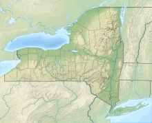
Schenectady County Airport (IATA: SCH, ICAO: KSCH, FAA LID: SCH) is a county-owned, public-use airport located three nautical miles (6 km) north of the central business district of Schenectady, a city in Schenectady County, New York, United States.[1] It is included in the National Plan of Integrated Airport Systems for 2011–2015, which categorized it as a reliever airport.[2]
Founded in 1927, the airport is home to Richmor Aviation, Fortune Air, the 109th Airlift Wing (109 AW) of the New York Air National Guard, the Empire State Aerosciences Museum, and several private aircraft.
- ^ a b FAA Airport Form 5010 for SCH PDF. Federal Aviation Administration. Effective August 10, 2023.
- ^ "2011–2015 NPIAS Report, Appendix A (PDF, 2.03 MB)" (PDF). FAA.Gov. Federal Aviation Administration. October 4, 2010.

