Schramberg | |
|---|---|
 Coat of arms | |
Location of Schramberg within Rottweil district 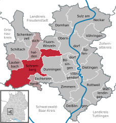 | |
 Schramberg  Schramberg | |
| Coordinates: 48°13′37″N 08°23′03″E / 48.22694°N 8.38417°E | |
| Country | Germany |
| State | Baden-Württemberg |
| Admin. region | Freiburg |
| District | Rottweil |
| Subdivisions | Town centre plus three districts |
| Government | |
| • Lord mayor (2019–27) | Dorothee Eisenlohr[1] (Ind.) |
| Area | |
| • Total | 80.70 km2 (31.16 sq mi) |
| Elevation | 424 m (1,391 ft) |
| Population (2022-12-31)[2] | |
| • Total | 21,125 |
| • Density | 260/km2 (680/sq mi) |
| Time zone | UTC+01:00 (CET) |
| • Summer (DST) | UTC+02:00 (CEST) |
| Postal codes | 78142-44, 78701–13 |
| Dialling codes | 07422 |
| Vehicle registration | RW |
| Website | schramberg.de |
Schramberg is a town in the district of Rottweil, in Baden-Württemberg, Germany. It is situated in the eastern Black Forest, 25 km northwest of Rottweil. With all of its districts (Talstadt, Sulgen, Waldmössingen, Heiligenbronn, Schönbronn and Tennenbronn (since 2006)), it has about 22,000 inhabitants.
One of the streams flowing through the Schramberg valley is the Schiltach. The "Bach na Fahrt", a traditional raft race held on Carnival Monday, is known far and wide and attracts up to 30,000 spectators each year.[3]
- ^ Aktuelle Wahlergebnisse, Staatsanzeiger, accessed 14 September 2021.
- ^ "Bevölkerung nach Nationalität und Geschlecht am 31. Dezember 2022" [Population by nationality and sex as of December 31, 2022] (CSV) (in German). Statistisches Landesamt Baden-Württemberg. June 2023.
- ^ "Schramberg in the Black Forest".