| Geography | |
|---|---|
| Location | Nova Scotia, Canada |
| Coordinates | 43°24′56.1″N 66°0′37.4″W / 43.415583°N 66.010389°W |
| Length | 4.3 km (2.67 mi) |
| Width | 0.8 km (0.5 mi) |
| Administration | |
| Province | Nova Scotia |

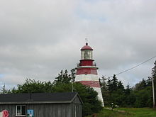
Seal Island (also known as Great Seal Island) is an island on the outermost extreme of Southwestern Nova Scotia, Canada, in the Municipality of the District of Argyle in Yarmouth County.[1] It is approximately 4.3 kilometres (2.7 mi) long and 0.8 kilometres (0.50 mi) wide and is surrounded on its east, south and west sides by dangerous shoals.[2] It is surrounded by the Atlantic Ocean and is the biggest of a group of five islands which extend north for 12 kilometres (7.5 mi).[3] It is the second southernmost point of land of Nova Scotia. The southern tip of nearby Cape Sable Island is 250 metres (820 ft) farther south than the southern tip of land on Seal Island.
- ^ "Seal Island". Place Names. Natural Resources Canada. Retrieved 2 October 2015.
- ^ Mc.Dougall, G.F. (1867). Sailing directions for the south-east coast of Nova Scotia and bay of Fundy. Hydrographic Office, Admiralty. p. 148. Retrieved 2 October 2015.
- ^ Seal Island, Nova Scotia "Sailing Directions for Seal Island Nova Scotia". Archived from the original on 2007-02-15. Retrieved 2010-12-05.
