This article needs additional citations for verification. (August 2010) |
| Seine River | |
|---|---|
 | |
| Etymology | Named after the Seine River in France |
| Location | |
| Country | Canada |
| Province | Ontario |
| Region | Northwestern Ontario |
| Districts | |
| Physical characteristics | |
| Source | Lac des Mille Lacs |
| • location | Thunder Bay District |
| • coordinates | 48°58′46″N 90°43′49″W / 48.97944°N 90.73028°W |
| • elevation | 457 m (1,499 ft) |
| Mouth | Rainy Lake |
• location | Rainy River District |
• coordinates | 48°39′56″N 92°49′19″W / 48.66556°N 92.82194°W |
• elevation | 338 m (1,109 ft) |
| Length | 240 km (150 mi) |
| Basin features | |
| River system | Hudson Bay drainage basin |
| Tributaries | |
| • left | Atikokan River, Mercutio River |
| • right | Eye River, Firesteel River |
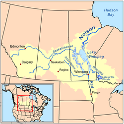
The Seine River is a river in Kenora, Rainy River and Thunder Bay Districts in northwestern Ontario, Canada. It flows 240 kilometres (149 mi) from Lac des Mille Lacs to Rainy Lake.
The river was an important route in the days of the fur trade. Gold was discovered along the river near the end of the 19th century and several mining operations established in the area. In 1943, a section of the river was diverted near Steep Rock Lake to gain access to a large iron ore deposit under the lake. That mine has since been closed. The river is used for recreational canoeing and kayaking.
