41°08′N 83°08′W / 41.13°N 83.13°W
Seneca County | |
|---|---|
 | |
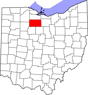
 Location within the U.S. state of Ohio | |
 Ohio's location within the U.S. | |
| Coordinates: 41°08′N 83°08′W / 41.13°N 83.13°W | |
| Country | |
| State | |
| Founded | April 1, 1824 |
| Named for | the Seneca nation |
| Seat | Tiffin |
| Largest city | Tiffin |
| Area | |
• Total | 553 sq mi (1,430 km2) |
| • Land | 551 sq mi (1,430 km2) |
| • Water | 1.8 sq mi (5 km2) 0.3% |
| Population (2020) | |
• Total | 55,069 |
| • Density | 100/sq mi (40/km2) |
| Time zone | UTC−5 (Eastern) |
| • Summer (DST) | UTC−4 (EDT) |
| Congressional district | 5th |
| Website | senecacountyohio |
Seneca County is a county located in the northwestern part of the U.S. state of Ohio. As of the 2020 census, the population was 55,069.[1] Its county seat is Tiffin.[2] The county was created in 1820 and organized in 1824.[3] It is named for the Seneca Indians, the westernmost nation of the Iroquois Confederacy. This people were based in present-day New York but had territory extending into Pennsylvania and Ohio.[4] Seneca County comprises the Tiffin, OH Micropolitan Statistical Area, which is also included in the Findlay–Tiffin, OH Combined Statistical Area.
- ^ 2020 census
- ^ "Find a County". National Association of Counties. Retrieved June 7, 2011.
- ^ "Ohio: Individual County Chronologies". Ohio Atlas of Historical County Boundaries. The Newberry Library. 2007. Archived from the original on April 6, 2016. Retrieved February 14, 2015.
- ^ Cite error: The named reference
osuedcwas invoked but never defined (see the help page).

