Sengkang | |
|---|---|
| Other transcription(s) | |
| • Chinese | 盛港 Shènggǎng (Pinyin) Sêng-káng (Hokkien POJ) |
| • Malay | Sengkang |
| • Tamil | செங்காங் Ceṅkāṅ (Transliteration) |
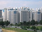
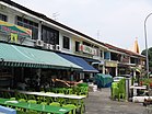
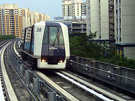
From top; left to right: Panoramic view of Sungei Serangoon with Rivervale on the west bank, Compassvale, Jalan Kayu, Sengkang LRT Line, Ranggung LRT Station, Sengkang Sculpture Park, Fernvale Primary School | |
 Location of Sengkang in Singapore | |
| Coordinates: 1°23′30″N 103°53′40″E / 1.39167°N 103.89444°E | |
| Country | |
| Region | North-East Region
|
| CDCs | |
| Government | |
| • Mayors | Central Singapore CDC
North East CDC |
| • Members of Parliament | Ang Mo Kio GRC
Sengkang GRC |
| Area | |
| • Total | 10.59 km2 (4.09 sq mi) |
| • Residential | 3.97 km2 (1.53 sq mi) |
| Population | |
| • Total | 249,370 |
| • Density | 24,000/km2 (61,000/sq mi) |
| Postal district | 19, 28 |
| Dwelling units | 59,497 |
| Projected ultimate | 92,000 |
This article needs additional citations for verification. (February 2023) |
Sengkang (Chinese: 盛港, Tamil: செங்காங்) is a planning area and residential town located in the North-East Region of Singapore. The town is the second most populous in the region, being home to 249,370 residents in 2020.[4] Sengkang shares boundaries with Seletar and Punggol in the north, Pasir Ris and Paya Lebar in the east, Hougang and Serangoon to the south, as well as Yishun and Ang Mo Kio to the west.
Originally a fishing village, the area underwent rapid development under the ambition of the Housing and Development Board (HDB) to transform it into a fully mature housing estate.[5][6]
- ^ Key Statistics | HDB Annual Report 2014/2015 (Report). Housing and Development Board. p. 10. Archived from the original on 4 March 2016. Retrieved 17 February 2018.
- ^ "Statistics Singapore - Geographic Distribution - 2018 Latest Data". Archived from the original on 30 January 2016. Retrieved 11 February 2019.
- ^ "Land Area and Dwelling Units by Town". Data Singapore. 2016. Archived from the original on 12 June 2019. Retrieved 26 January 2018.
- ^ "Sengkang (Planning Area, Singapore) - Population Statistics, Charts, Map and Location". www.citypopulation.de. Archived from the original on 25 May 2020. Retrieved 14 April 2020.
- ^ Tee Hun Ching (24 September 2000). "Life behind the vales". The Straits Times.
- ^ Housing and Development Board (4 October 2017). "Sengkang | HDB InfoWEB". Archived from the original on 24 February 2021. Retrieved 29 December 2017.


