| Serra do Divisor National Park | |
|---|---|
| Parque Nacional da Serra do Divisor | |
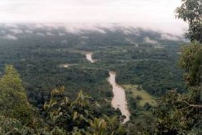
 Moa River in Serra do Divisor National Park | |
| Location | Acre, Brazil |
| Coordinates | 8°22′S 73°20′W / 8.36°S 73.33°W[1] |
| Area | 8,463 km2 (3,268 sq mi) |
| Designation | National park |
| Established | 1989 |
| -- | |
The Serra do Divisor National Park (Portuguese: Parque Nacional da Serra do Divisor) is a 8,463 km2 (3,268 sq mi) national park on the westernmost point of Brazil, in the state of Acre, near the Peruvian border. It also has the highest point in that state, reaching 609 meters above sea level. It has been nominated by the Brazilian government as a Tentative World Heritage Site since 1998.
