| Sgurra Bhreac | |
|---|---|
| the Big Rock | |
 Sgurra Bhreac lies in the East Bay Hills | |
| Highest point | |
| Elevation | 222 m (728 ft)[1] |
| Prominence | 212 m (696 ft)[2] |
| Coordinates | 45°55′42.88972″N 60°25′46.70739″W / 45.9285804778°N 60.4296409417°W |
| Naming | |
| Etymology | name means spotted or pitted ridge or rock in Gaelic |
| Geography | |
| Parent range | East Bay Hills |
| Topo map | NTS 11F16 Mira River |
| Climbing | |
| Easiest route | drive / hike |
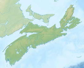
Sgurra Bhreac[3] (alternative spelling 'Sgurra Breac'), sometimes referred to as the Big Rock, is a Canadian peak in the East Bay Hills of Cape Breton Island, an extension of the Appalachian mountain chain in the province of Nova Scotia. Sgurra Bhreac is a prominent rock outcrop, rising 50 m (160 ft) from the northern edge of The Big Barren, between the Breac Brook and Glengarry Valleys, and is the highest point on Cape Breton Island south of the Bras d'Or Lake with its summit at 222 m (728 ft).

- ^ The Nova Scotia Atlas: Province of Nova Scotia. Government of Nova Scotia. 16 June 2006. p. 24, V2. ISBN 9780887807077. Retrieved 18 June 2018.
- ^ "Sgurra Bhreac, Nova Scotia". Peakbagger.com. Retrieved 9 April 2012.
- ^ Geographical Names of Canada - Sgurra Bhreac

