Shahekou
沙河口区 | ||||||||||||||||||||||||||||||||||
|---|---|---|---|---|---|---|---|---|---|---|---|---|---|---|---|---|---|---|---|---|---|---|---|---|---|---|---|---|---|---|---|---|---|---|
 | ||||||||||||||||||||||||||||||||||
 | ||||||||||||||||||||||||||||||||||
| Coordinates: 38°54′17″N 121°35′43″E / 38.9046°N 121.5952°E | ||||||||||||||||||||||||||||||||||
| Country | People's Republic of China | |||||||||||||||||||||||||||||||||
| Province | Liaoning | |||||||||||||||||||||||||||||||||
| Sub-provincial city | Dalian | |||||||||||||||||||||||||||||||||
| Seat | No. 393 Zhongshan Road (中山路393号) | |||||||||||||||||||||||||||||||||
| Area | ||||||||||||||||||||||||||||||||||
| • Total | 34.71 km2 (13.40 sq mi) | |||||||||||||||||||||||||||||||||
| Population | ||||||||||||||||||||||||||||||||||
| • Total | 693,140 | |||||||||||||||||||||||||||||||||
| • Density | 20,000/km2 (52,000/sq mi) | |||||||||||||||||||||||||||||||||
| Time zone | UTC+8 (China Standard) | |||||||||||||||||||||||||||||||||
| Dalian district map |
| |||||||||||||||||||||||||||||||||
| Division code | 210204 | |||||||||||||||||||||||||||||||||
| Website | www | |||||||||||||||||||||||||||||||||
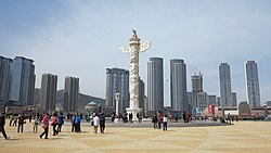
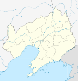
Shahekou District (simplified Chinese: 沙河口区; traditional Chinese: 沙河口區; pinyin: Shāhékǒu Qū) is one of the seven districts of Dalian, Liaoning province, People's Republic of China, forming part of the urban core. It is located in the western portion of the city. Its area is 34.71 square kilometres (13.40 sq mi) and its permanent population as of 2010[update] is 693,140, making it Dalian's most densely populated county-level division.[1][2] Its postal code is 116021, and the district government is seated at 393 Zhongshan Road.[4]
- ^ a b Dalian Statistical Yearbook 2012 (《大连统计年鉴2012》). Accessed 8 July 2014.
- ^ a b 2010 Census county-by-county statistics (《中国2010年人口普查分县资料》). Accessed 8 July 2014.
- ^ 沙河口区历史沿革 [Shahekou District Historical Development] (in Simplified Chinese). XZQH.org. 28 July 2015. Retrieved 17 October 2018.
2010年第六次人口普查,沙河口区常住总人口693140人,其中:
- ^ 沙河口区概况地图. XZQH.org (in Chinese). 2015-07-28. Archived from the original on 2021-01-01. Retrieved 2021-01-01.

