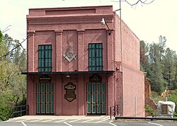
Shasta | |
|---|---|
 Historic Masonic Hall | |
| Coordinates: 40°35′32″N 122°28′40″W / 40.59222°N 122.47778°W | |
| Country | |
| State | |
| County | Shasta |
| Area | |
| • Total | 10.982 sq mi (28.444 km2) |
| • Land | 10.978 sq mi (28.433 km2) |
| • Water | 0.004 sq mi (0.012 km2) 0.04% |
| Elevation | 843 ft (257 m) |
| Population (2020) | |
| • Total | 1,043 |
| • Density | 95/sq mi (37/km2) |
| Time zone | UTC-8 (Pacific (PST)) |
| • Summer (DST) | UTC-7 (PDT) |
| GNIS feature ID | 2583135 |
| U.S. Geological Survey Geographic Names Information System: Shasta, California; | |
Shasta State Historic Park | |
| Location | Shasta, California |
| NRHP reference No. | 71000199[3] |
| CHISL No. | 77[4] |
| Significant dates | |
| Added to NRHP | October 14, 1971 |
| Designated CHISL | 1932 |
Shasta is a census-designated place (CDP) in Shasta County, California,[2] United States. Shasta sits at an elevation of 843 feet (257 m).[2] Its population is 1,043 as of the 2020 census, down from 1,771 from the 2010 census.
Shasta State Historic Park located at Shasta is a ghost town and California State Historic Park.
- ^ U.S. Census Archived 2012-01-25 at the Wayback Machine
- ^ a b c U.S. Geological Survey Geographic Names Information System: Shasta, California
- ^ "National Register Information System". National Register of Historic Places. National Park Service. April 15, 2008.
- ^ "Shasta". Office of Historic Preservation, California State Parks. Retrieved October 14, 2012.

