City of Shasta Lake | |
|---|---|
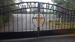
 St. Michael's Catholic Church | |
 Location in Shasta County and the state of California | |
| Coordinates: 40°40′52.3″N 122°21′59.8″W / 40.681194°N 122.366611°W | |
| Country | |
| State | |
| County | Shasta |
| Incorporated | July 2, 1993[1] |
| Area | |
| • Total | 10.93 sq mi (28.30 km2) |
| • Land | 10.92 sq mi (28.29 km2) |
| • Water | 0.01 sq mi (0.01 km2) 0.07% |
| Elevation | 810 ft (246 m) |
| Population (2020) | |
| • Total | 10,371 |
| • Density | 950/sq mi (370/km2) |
| Time zone | UTC-8 (Pacific (PST)) |
| • Summer (DST) | UTC-7 (PDT) |
| ZIP codes | 96019, 96079, 96089 |
| Area code | 530 |
| FIPS code | 06-71225 |
| GNIS feature ID | 1662287 |
| Website | https://www.cityofshastalake.org/ |
The City of Shasta Lake, known as Central Valley or CV prior to incorporation, is a city in Shasta County, California, United States. It is the closest settlement to Shasta Dam and Shasta Lake reservoir, which are popular tourist destinations. Its population is 10,371 as of the 2020 census, up from 10,164 from the 2010 census.
- ^ "California Cities by Incorporation Date". California Association of Local Agency Formation Commissions. Archived from the original (Word) on October 17, 2013. Retrieved August 25, 2014.
- ^ "2019 U.S. Gazetteer Files". United States Census Bureau. Retrieved July 1, 2020.
