Shawnee, Oklahoma
Shânîheki | |
|---|---|
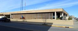
 Shawnee City Hall (2016) | |
 | |
| Coordinates: 35°20′33″N 96°56′2″W / 35.34250°N 96.93389°W | |
| Country | United States |
| State | Oklahoma |
| County | Pottawatomie |
| Government | |
| • Type | Mayor-Council |
| • Mayor | Ed Bolt (D)[citation needed] |
| Area | |
| • Total | 40.91 sq mi (105.95 km2) |
| • Land | 38.61 sq mi (99.99 km2) |
| • Water | 2.30 sq mi (5.96 km2) |
| Elevation | 1,053 ft (321 m) |
| Population (2020) | |
| • Total | 31,377 |
| • Density | 812.75/sq mi (313.81/km2) |
| Time zone | UTC−6 (Central (CST)) |
| • Summer (DST) | UTC−5 (CDT) |
| ZIP codes | 74801, 74802, 74804 |
| Area code(s) | 405/572 |
| FIPS code | 40-66800 [3] |
| GNIS feature ID | 2411879[2] |
| Website | ShawneeOK.org |
Shawnee (Meskwaki: Shânîheki[4]) is a city in and the county seat of Pottawatomie County, Oklahoma, United States.[5] The population was 29,857 in 2010, a 4.9 percent increase from the figure of 28,692 in 2000.[6] The city is part of the Oklahoma City-Shawnee Combined Statistical Area and the principal city of the Shawnee Micropolitan Statistical Area.
With access to Interstate 40, Shawnee is approximately 45 minutes east of downtown Oklahoma City. To the east and northeast, Shawnee is 112 miles from the McClellan-Kerr Arkansas River Navigation System, which provides shipping barge access to the Gulf of Mexico.
- ^ "ArcGIS REST Services Directory". United States Census Bureau. Retrieved September 20, 2022.
- ^ a b U.S. Geological Survey Geographic Names Information System: Shawnee, Oklahoma
- ^ "U.S. Census website". United States Census Bureau. Retrieved January 31, 2008.
- ^ Whittaker, Gordon (2005). A Concise Dictionary of the Sauk Language (PDF). Stroud, OK: The Sac & Fox National Public Library.
- ^ "Find a County". National Association of Counties. Retrieved June 7, 2011.
- ^ "Shawnee, OK Population - Census 2010 and 2000 Interactive Map, Demographics, Statistics, Quick Facts - CensusViewer". censusviewer.com. Retrieved April 7, 2018.