This article needs additional citations for verification. (January 2012) |
Shawnee County | |
|---|---|
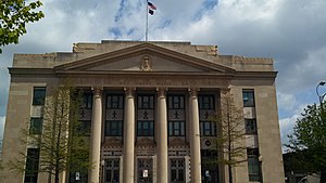
 United States Post Office and Historic Courthouse in Topeka (2013) | |
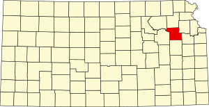
 Location within the U.S. state of Kansas | |
 Kansas's location within the U.S. | |
| Coordinates: 38°54′12″N 95°49′53″W / 38.9033°N 95.8314°W | |
| Country | |
| State | |
| Founded | August 25, 1855 [1] |
| Named for | Shawnee people |
| Seat | Topeka |
| Largest city | Topeka |
| Area | |
• Total | 556 sq mi (1,440 km2) |
| • Land | 544 sq mi (1,410 km2) |
| • Water | 12 sq mi (30 km2) 2.1% |
| Population | |
• Total | 178,909 |
• Estimate (2023)[3] | 177,746 |
| • Density | 328.9/sq mi (127.0/km2) |
| Time zone | UTC−6 (Central) |
| • Summer (DST) | UTC−5 (CDT) |
| Congressional district | 2nd |
| Website | snco.us |
Shawnee County is located in northeast Kansas, in the central United States. Its county seat and most populous city is Topeka, the state capital.[4] As of the 2020 census, the population was 178,909,[2] making it the third-most populous county in Kansas. The county was one of the original 33 counties created by the first territorial legislature in 1855, and it was named for the Shawnee tribe.
- ^ "Kansas Counties - Shawnee County, Kansas". Kansas State Historical Society. Archived from the original on November 19, 2007. Retrieved January 10, 2008.
- ^ a b "QuickFacts; Shawnee County, Kansas; Population, Census, 2020 & 2010". United States Census Bureau. Archived from the original on August 15, 2021. Retrieved August 15, 2021.
- ^ "Annual Estimates of the Resident Population for Counties: April 1, 2020 to July 1, 2023". United States Census Bureau. Retrieved March 24, 2024.
- ^ "Find a County". National Association of Counties. Retrieved June 7, 2011.

