Sherborn, Massachusetts | |
|---|---|
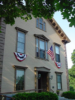
 Sherborn Community Center | |
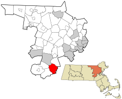
 Location in Middlesex County in Massachusetts | |
| Coordinates: 42°14′20″N 71°22′13″W / 42.23889°N 71.37028°W | |
| Country | United States |
| State | Massachusetts |
| County | Middlesex |
| Settled | 1652 |
| Incorporated | 1674 |
| Government | |
| • Type | Open town meeting |
| Area | |
| • Total | 16.2 sq mi (41.9 km2) |
| • Land | 16.0 sq mi (41.3 km2) |
| • Water | 0.2 sq mi (0.6 km2) |
| Elevation | 175 ft (53 m) |
| Population (2020) | |
| • Total | 4,401 |
| • Density | 275.1/sq mi (106.6/km2) |
| Time zone | UTC−5 (Eastern) |
| • Summer (DST) | UTC−4 (Eastern) |
| ZIP Code | 01770 |
| Area code | 508/774 |
| FIPS code | 25-61380 |
| GNIS feature ID | 0618233 |
| Website | www.sherbornma.org |
Sherborn is a town in Middlesex County, Massachusetts, United States. Located in Boston's MetroWest region, the community is within area code 508 and has the ZIP Code 01770. As of the 2020 U.S. Census, the town population was 4,401.[1]
Sherborn shares its highly ranked public school system with the town of Dover. In addition to Dover, Sherborn is bordered by the towns of Natick, Framingham, Ashland, Millis, Holliston, and Medfield.
- ^ "Census - Geography Profile: Sherborn town, Middlesex County, Massachusetts". United States Census Bureau. Retrieved November 6, 2021.
