Native name: Inis Arcáin | |
|---|---|
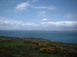
 View from the highest point of Sherkin Island | |
| Geography | |
| Location | Celtic Sea |
| Coordinates | 51°28′N 9°25′W / 51.467°N 9.417°W |
| Area | 5 km2 (1.9 sq mi)approx |
| Highest elevation | 189.3 m (621.1 ft) |
| Administration | |
| Province | Munster |
| County | Cork |
| Demographics | |
| Population | 110 (2022)[1] |


Sherkin Island, historically called Inisherkin (Irish: Inis Arcáin),[2] lies southwest of County Cork in Ireland alongside other islands of Roaringwater Bay. It had a population of 111 people at the time of the 2016 Census,[3] and measures five kilometres (three miles) long by 2.5 kilometres (1+1⁄2 miles) wide. The island has one pub, a bed and breakfast, a community centre and a Roman Catholic church.
- ^ Population of Inhabited Islands Off the Coast (Report). Central Statistics Office. 2023. Retrieved 29 June 2023.
- ^ "Inis Arcáin – Sherkin Island". Irish Placenames Database (logainm.ie). Retrieved 20 February 2016.
- ^ "Populated off-shore islands". chg.gov.ie. Retrieved 20 May 2018.
