Shimoga | |
|---|---|
| Shivamogga | |
|
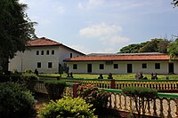
Images, from top down, left right Indian lion in the Tyavarekoppa Tiger and Lion Reserve Statue of Keladi Shivappa Nayaka Sculpture of Mahishasura Mardhini Shivappa Nayaka palace | |
 Shivamogga in Karnataka | |
| Coordinates: 13°56′N 75°34′E / 13.933°N 75.567°E | |
| Country | |
| State | Karnataka |
| District | Shimoga |
| Region | Malenadu |
| Government | |
| • Type | City Corporation |
| • Body | Shivamogga Mahanagara Palike |
| Area | |
| • City | 70.01 km2 (27.03 sq mi) |
| • Rural | 1,037.29 km2 (400.50 sq mi) |
| Elevation | 569 m (1,867 ft) |
| Population (2011)[2] | |
| • City | 322,650 |
| • Rank | 10th (Karnataka) |
| • Density | 4,600/km2 (12,000/sq mi) |
| • Rural | 184,674 |
| Time zone | UTC+5:30 (IST) |
| PIN | 577201 - 577205 |
| Telephone code | 91-(0)8182-XXXXXX |
| ISO 3166 code | IN-KA |
| Vehicle registration | KA-14 |
| Official language | Kannada[3] |
| Climate | Aw |
| Website | shivamoggacitycorp |
Shimoga, officially Shivamogga,[4] is a city and the district headquarters of Shimoga district in the Karnataka state of India. The city lies on the banks of the Tunga River. Being the gateway for the hilly region of the Western Ghats, the city is popularly nicknamed the "Gateway of Malnad".[5] The population of Shimoga city is 322,650 as per 2011 census.[2] The city has been selected for the Smart Cities project, standing in the fourth position in the state and 25th in the country as of November 2020.[6]
The city is 569 m above sea level and is surrounded by lush green paddy fields, arecanut and coconut groves. It is located 267 km from the state capital Bangalore and 195 km from the port city Mangalore.[7]
- ^ "About Our District - Shivamogga". District Urban Development Cell, Shivamogga - Official Website of Directorate of Municipal Administration. Retrieved 24 November 2023.
- ^ a b c Cite error: The named reference
Census2011Govwas invoked but never defined (see the help page). - ^ "50th Report of the Commissioner for Linguistic Minorities in India (July 2012 to June 2013)" (PDF). Archived from the original (PDF) on 8 July 2016. Retrieved 14 January 2015.
- ^ "Bangalore becomes 'Bengaluru'; 11 other cities renamed". The Economic Times. PTI. 1 November 2014. Retrieved 18 July 2018.
- ^ "85 per cent unused funds leaves Shivamogga scruffy". The New Indian Express. 6 May 2018. Retrieved 23 February 2021.
- ^ "Push to complete Smart City project works on time". The Hindu. 24 November 2020. Retrieved 12 February 2021.
- ^ "Shimoga | Shivamogga | Sightseeing Shimoga | Wildlife Shimoga". Karnataka.com. 18 August 2016. Retrieved 10 April 2020.


