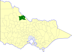
| Shire of Kerang Victoria | |||||||||||||||
|---|---|---|---|---|---|---|---|---|---|---|---|---|---|---|---|
 Location in Victoria | |||||||||||||||
| Population | 4,380 (1992)[1] | ||||||||||||||
| • Density | 1.3458/km2 (3.486/sq mi) | ||||||||||||||
| Established | 1862 | ||||||||||||||
| Area | 3,254.45 km2 (1,256.6 sq mi) | ||||||||||||||
| Council seat | Kerang | ||||||||||||||
| Region | Mallee | ||||||||||||||
| County | Gunbower, Tatchera | ||||||||||||||
 | |||||||||||||||
The Shire of Kerang was a local government area located in northwestern Victoria, Australia, along the Murray River. The shire covered an area of 3,254.45 square kilometres (1,256.6 sq mi), and existed from 1862 until 1995. From 1966 onwards, Kerang itself was managed by a separate entity; the Borough of Kerang.