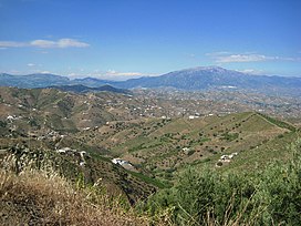
| Sierra de Tejeda | |
|---|---|
 | |
| Highest point | |
| Peak | La Maroma |
| Elevation | 2,066 m (6,778 ft) |
| Coordinates | 36°54′18″N 4°02′11″W / 36.904910°N 4.036516°W |
| Naming | |
| Etymology | The name "Tejeda'" refers to the abundance of Taxus baccata (yew) trees in the past. |
| Geography | |
| Country | Spain |
| Autonomous community | Andalusia |
| Provinces | Málaga and Granada |
| Geology | |
| Age of rock | 300 million years |
| Mountain type | Mountain range |
| Type of rock | Calcareous formations |
The Sierra de Tejeda is a mountain range in the Penibaetic System of mountains between the provinces of Málaga and Granada in Spain. Together with the Sierra de Almijara to the east and the Sierra de Alhama to the west it constitutes a limestone massif that acts as a physical border between the two provinces, separating the Axarquía from the depression of Granada. The mountains contain the Sierras of Tejeda, Almijara and Alhama Natural Park.
