| Siltcoos River | |
|---|---|
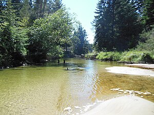
 The river just below the dam near Siltcoos Lake | |
| Etymology | A local Native American chief and family, it is said.[2] |
| Location | |
| Country | United States |
| State | Oregon |
| County | Douglas and Lane |
| Physical characteristics | |
| Source | Siltcoos Lake |
| • location | near Westlake |
| • coordinates | 43°52′53″N 124°06′45″W / 43.88139°N 124.11250°W[1] |
| • elevation | 12 ft (3.7 m)[3] |
| Mouth | Pacific Ocean |
• coordinates | 43°52′25″N 124°09′14″W / 43.87361°N 124.15389°W[1] |
• elevation | 10 ft (3.0 m)[1] |
The Siltcoos River is a 3-mile (4.8 km) stream on the central coast of the U.S. state of Oregon. It begins at Siltcoos Lake, which straddles the border between Douglas and Lane counties. The river meanders generally west to the Pacific Ocean. It is located about 8 miles (13 km) south of Florence and 13 miles (21 km) north of Reedsport.[4] The river, losing little elevation between source and mouth,[1] passes through the Westlake section of Dunes City, under U.S. Route 101, and through a marshy area and sand dunes of Oregon Dunes National Recreation Area, which is within Siuslaw National Forest.[4]
- ^ a b c d "Siltcoos River". Geographic Names Information System. United States Geological Survey. November 28, 1980. Retrieved April 16, 2012.
- ^ McArthur, Lewis A.; McArthur, Lewis L. (2003) [1928]. Oregon Geographic Names (7th ed.). Portland: Oregon Historical Society Press. p. 876. ISBN 0-87595-277-1.
- ^ Source elevation derived from Google Earth search using GNIS source coordinates.
- ^ a b Oregon Atlas & Gazetteer. Freeport, Maine: DeLorme Mapping. 1991. p. 32. ISBN 0-89933-235-8.
