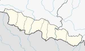
Simraungadh | |
|---|---|
Municipality | |
 | |
| Coordinates: (26.8893386, 85.1168150)26°53′22″N 85°7′1″E / 26.88944°N 85.11694°E | |
| Country | Nepal |
| Province | Madhesh Province |
| District | Bara District |
| Government | |
| • Mayor | Kishori Sah Kalwar (Loktantrik Samajwadi Party, Nepal) |
| • Deputy Mayor | Najmu Sehar (Loktantrik Samajwadi Party, Nepal) |
| Area | |
| • Total | 42.65 km2 (16.47 sq mi) |
| Population (2011) | |
| • Total | 49,939 |
| Time zone | UTC+5:45 (NST) |
| Website | www.simraungadhmun.gov.np |
Simraungadh, Simraongarh or Simroungarh (/ˈsiːmraʊnɡɜːr/, Devanagari: सिम्रौनगढ) is a municipality situated in Bara district of Nepal.
The municipality was created in 2014 by agglomerating the Village Development Committees of Amritganj, Golaganj, Hariharpur & Uchidih and later on expanded the municipality areas to include Bhagwanpur, Kachorwa, Dewapur-Teta, and Bishnupur,BadkaItwal]].[1][2][3][4][5]
The municipality is also contains parts of an archaeological site which is split between Indian and Nepal and which finds mention in the travel accounts of a Tibetan monk and pilgrim, Dharmasvamin (1236)[6][7] when he was on his way back to Nepal And Tibet, an Italian Missionary traveler, Cassiano Beligatti (1740),[8][9] Colonel James Kirkpatrick (1801) on his mission to Nepal[10] and later used in 1835 by British ethnologist Brian Houghton Hodgson.[11]
The city is located along the border between India and Nepal. It lies 90 km (56 mi) south of Nepal's capital, Kathmandu, and 28 km (17 mi) east of Birgunj metro city.[12] Bhojpuri is the local language of Simraungadh.[13]
- ^ Magazine, New Spolight. "Nepal government declares 61 new municipalities". SpotlightNepal. Retrieved 2019-02-03.
- ^ "PM formally announces 744 local units operational". My Republica. Archived from the original on 13 August 2018. Retrieved 13 August 2018.
- ^ "स्थानिय तह" [Local Unit]. 103.69.124.141. Archived from the original on 31 August 2018. Retrieved 1 September 2018.
- ^ "Population Ward Level 753 Local Unit" (PDF). CBS. 2 June 2017. Archived (PDF) from the original on 27 January 2018.
- ^ Nepal, Government of Nepal (November 2012). ""National Population and Housing Census 2011 (Village Development Committee/Municipality)" (PDF). National Planning Commission. Archived (PDF) from the original on 21 December 2016.
- ^ Roerich, George Dr. (1959). "Biography Of Dharmasvamin (1959)". K.P. Jayaswal Research Institute: 18.
- ^ Chaudhary P. C. Roy (1964). "Bihar District Gazetteers Darbhanga".
{{cite journal}}: Cite journal requires|journal=(help) - ^ Petech, Luciano (1952). I missionari italiani nel Tibet e nel Nepal (in Italian). Libreria dello Stato. p. 809.
- ^ Ippolito, Desideri (1995). An account of Tibet : the travels of Ippolito Desideri, 1712-1727. New Delhi: Asian Educational Services. pp. 322–323. ISBN 978-8120610194. OCLC 33941427.
- ^ Aitchison.c.u (1910). "The Treaties Amp Relating To Hyderabad Mysore And Coorg". Retrieved 2019-02-03.
- ^ Hodgson, B. H. (1835). "Account of a Visit to the Ruins of Simroun, once the capital of the Mithila province". Journal of the Asiatic Society. 4: 121−124.
- ^ Sah, Bharat. "सिम्रौनगढ : सम्पदा संरक्षणमा चुनौती" [Simraungadh: Challenge in heritage conservation]. Online Khabar (in Nepali). Retrieved 2019-02-10.
- ^ Gopal Thakur Lohar (2006-06-04). A Sociolinguistic Survey of the Bhojpuri Language in Nepal.

