| Small Isles | |
|---|---|
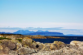
 A distant view of Eigg, with the hills of Rùm behind. | |
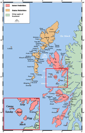
 The location of the Small Isles within the Hebrides | |
| Location | Lochaber, Highland, Scotland |
| Coordinates | 56°58′N 6°16′W / 56.967°N 6.267°W |
| Area | 472 km2 (182 sq mi)[1] |
| Established | 1981 |
| Governing body | NatureScot |


The Small Isles (Scottish Gaelic: Na h-Eileanan Tarsainn[2]) are a small archipelago in the Inner Hebrides, off the west coast of Scotland. They lie south of Skye and north of Mull and Ardnamurchan – the most westerly point of mainland Scotland.
Until 1891, Canna, Rùm and Muck belonged to the county of Argyll,[3] while Eigg belonged to Inverness-shire. In that year, the entire archipelago was transferred to Inverness-shire. They now belong to the Highland council area.[4]
- ^ Cite error: The named reference
nsa-areawas invoked but never defined (see the help page). - ^ Iain Mac an Tàilleir. "Placenames" (PDF). Pàrlamaid na h-Alba. Archived from the original (PDF) on 29 May 2008. Retrieved 23 July 2007.
- ^ "Argyll". Vision of Britain. University of Portsmouth. Retrieved 30 May 2020.
- ^ "Small Isles Community Council - Boundary Map". The Highland Council. April 2011. Retrieved 5 June 2018.