| Snowdon | |
|---|---|
| Yr Wyddfa (Welsh) | |
 The Snowdon group viewed from the north-east left to right Y Lliwedd, Crib Goch, Yr Wyddfa (the summit), Garnedd Ugain | |
| Highest point | |
| Elevation | 1,084.74 m (3,558.9 ft) [1][a] |
| Prominence | 1,039 m (3,409 ft) Ranked joint 3rd in British Isles |
| Parent peak | Ben Nevis |
| Isolation | 368.7 km (229.1 mi) |
| Listing | Marilyn, Furth, Hewitt, Nuttall, Welsh 3000s, council top, |
| Coordinates | 53°4′6.59″N 4°4′34.43″W / 53.0684972°N 4.0762306°W[2] |
| Geography | |
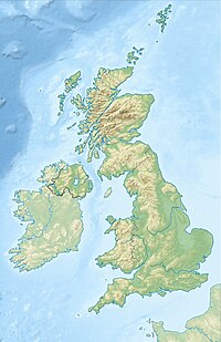
Gwynedd, Wales | |
| Parent range | Snowdonia |
| OS grid | SH6098954379 |
| Topo map | OS Landranger 115, Explorer OL17 |
| Climbing | |
| Easiest route | Llanberis Path |
| Name | Grid ref | Height | Status |
|---|---|---|---|
| Crib y Ddysgl | SH610551 | 1,065 m (3,494 ft) | Welsh 3000s, Hewitt, Nuttall |
| Crib Goch | SH624551 | 923 m (3,028 ft) | Welsh 3000s, Hewitt, Nuttall |
| Craig Fach | SH635552 | 609 m (1,998 ft) | sub-Hewitt |
| Craig Wen | SH597508 | 605 m (1,985 ft) | sub-Hewitt |
Snowdon (/ˈsnoʊdən/), or Yr Wyddfa (Welsh: [ər ˈʊɨ̞̯ðva] ), is a mountain in Snowdonia, a region of North Wales. It has an elevation of 1,085 metres (3,560 ft) above sea level, which makes it both the highest mountain in Wales and the highest in the British Isles south of the Scottish Highlands. Snowdon is designated a national nature reserve for its rare flora and fauna, and is located within Snowdonia National Park.
The rocks that form Snowdon were produced by volcanoes in the Ordovician period, and the massif has been extensively sculpted by glaciation, forming the pyramidal peak of Snowdon and the arêtes of Crib Goch and Y Lliwedd. It is part of the larger Snowdon range, which includes Garnedd Ugain, Yr Aran, and Moel Eilio.[3] There are several lakes on the mountain, the largest of which is Llyn Lydaw (110 acres (45 ha)), located on the eastern flank at 1,430 ft (440 m).
The mountain has been described as the "busiest in the United Kingdom", and in 2022 it was climbed by 543,541 walkers. There are six main paths to the summit, the most popular of which begins in the town of Llanberis to the north.[4] The summit can also be reached using the Snowdon Mountain Railway, which carried 98,567 passengers in 2021.[5] The rack railway, which opened in 1896, operates over 4+3⁄4 miles (7.6 kilometres), from Llanberis to the Summit station. It generally operates from March to the end of October, with trains running to the summit station from May. The cliff faces on Snowdon, including Clogwyn Du'r Arddu, are significant for rock climbing, and the mountain was used by Edmund Hillary in training for the 1953 ascent of Mount Everest. The mountain, alongside Ben Nevis in Scotland and Scafell Pike in England, is climbed as part of the National Three Peaks Challenge.[6]
- ^ "Snowdon Surveyed – But Just How High Is It?". ukhillwalking.com. 14 October 2014.
- ^ Edwardes, Simon. "Snowdon – Yr Wyddfa". The Mountains of England and Wales. Retrieved 28 April 2011.
- ^ "Walking in Snowdonia | The Snowdon Range". walk-snowdonia.co.uk. Retrieved 5 February 2024.
- ^ "SNPA – Visitor Monitoring Report, 2019" (PDF).
- ^ Davies, Michael; Pilsworth, Angharad (18 August 2022). "Visits to Tourist Attractions in Wales 2021: Report for Visit Wales" (PDF). gov.wales.
- ^ "National Three Peaks Challenge". 25 February 2011. Retrieved 28 April 2011.
Cite error: There are <ref group=lower-alpha> tags or {{efn}} templates on this page, but the references will not show without a {{reflist|group=lower-alpha}} template or {{notelist}} template (see the help page).

