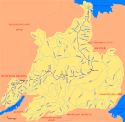
| Sobolokh-Mayan Yakut: Соболоох Майаан | |
|---|---|
 | |
Mouth location in Yakutia, Russia | |
| Location | |
| Country | Russia |
| Physical characteristics | |
| Source | |
| • location | Orulgan Range |
| • coordinates | 67°30′10″N 128°27′05″E / 67.50278°N 128.45139°E |
| • elevation | 1,500 m (4,900 ft) |
| Mouth | Lena |
• coordinates | 67°14′04″N 123°22′48″E / 67.23444°N 123.38000°E |
• elevation | 27 m (89 ft) |
| Length | 411 km (255 mi) |
| Basin size | 13,300 km2 (5,100 sq mi) |
| Discharge | |
| • average | 136 m3/s (4,800 cu ft/s) |
| Basin features | |
| Progression | Lena→ Laptev Sea |
The Sobolokh-Mayan (‹See Tfd›Russian: Соболоох-Майан; Yakut: Соболоох Майаан, Soboloox Mayaan) is a river in Sakha Republic (Yakutia), Russia. It is the 20th longest tributary of the Lena, with a length of 411 kilometres (255 mi) and a drainage basin area of 13,300 square kilometres (5,100 sq mi).[1]
Lenok, taimen and whitefish are found in the waters of the Sobolokh-Mayan. There are no settlements by the river.[2]
- ^ "Река Соболоох-Майан (Собопол) in the State Water Register of Russia". textual.ru (in Russian).
- ^ Water of Russia - Соболоох-Майан
