This article's lead section may be too short to adequately summarize the key points. (November 2020) |
Soldiers Grove, Wisconsin | |
|---|---|
 | |
| Nickname: America's First Solar Village | |
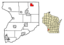
 Location of Soldiers Grove in Crawford County, Wisconsin. | |
| Coordinates: 43°23′45″N 90°46′20″W / 43.39583°N 90.77222°W | |
| Country | |
| State | |
| County | Crawford |
| Area | |
| • Total | 3.58 sq mi (9.28 km2) |
| • Land | 3.58 sq mi (9.28 km2) |
| • Water | 0.00 sq mi (0.00 km2) |
| Elevation | 725 ft (221 m) |
| Population | |
| • Total | 592 |
| • Estimate (2019)[4] | 541 |
| • Density | 150.95/sq mi (58.27/km2) |
| Time zone | UTC-6 (Central (CST)) |
| • Summer (DST) | UTC-5 (CDT) |
| Area code | 608 |
| FIPS code | 55-74550[5] |
| GNIS feature ID | 1574364[2] |
| Website | soldiersgrove |
Soldiers Grove is a village situated along the Kickapoo River in Crawford County, Wisconsin, in the United States. The population was 592 at the 2010 census. The town is notable for having relocated its central business district due to flooding on the nearby Kickapoo River during the 1970s, and has become a case study in best practices for managed retreat.[6]
- ^ "2019 U.S. Gazetteer Files". United States Census Bureau. Retrieved August 7, 2020.
- ^ a b "US Board on Geographic Names". United States Geological Survey. October 25, 2007. Retrieved January 31, 2008.
- ^ Cite error: The named reference
wwwcensusgovwas invoked but never defined (see the help page). - ^ Cite error: The named reference
USCensusEst2019CenPopScriptOnlyDirtyFixDoNotUsewas invoked but never defined (see the help page). - ^ "U.S. Census website". United States Census Bureau. Retrieved January 31, 2008.
- ^ FEMA, Village Locals Reflect Moving Was Best Flood Protection