Somers, Connecticut | |
|---|---|
| Town of Somers | |
 Free Public Library | |
| Coordinates: 41°59′N 72°27′W / 41.983°N 72.450°W | |
| Country | |
| U.S. state | |
| County | Tolland |
| Region | Capitol Region |
| Settled | 1689 |
| Named | 1734 |
| Annexed by Connecticut | 1749 |
| Government | |
| • Type | Selectman-town meeting |
| • First selectman | Timothy Keeney (R) |
| • Selectman | William Meier III (R) |
| • Selectman | Robert Schmidt (D) |
| Area | |
| • Total | 28.5 sq mi (73.8 km2) |
| • Land | 28.3 sq mi (73.4 km2) |
| • Water | 0.1 sq mi (0.3 km2) |
| Elevation | 240 ft (73 m) |
| Population (2020) | |
| • Total | 10,255 |
| • Density | 360/sq mi (140/km2) |
| Time zone | UTC-5 (Eastern) |
| • Summer (DST) | UTC-4 (Eastern) |
| ZIP Code | 06071 |
| Area code(s) | 860/959 |
| FIPS code | 09-69220 |
| GNIS feature ID | 0212346 |
| Website | www |
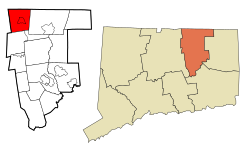
Somers (/ˈsʌmərs/ SUM-ərss) is a town in Tolland County, Connecticut, United States. The town is part of the Capitol Planning Region. The population was 10,255 at the 2020 census.[1] The town center is listed by the U.S. Census Bureau as a census-designated place (CDP). In 2007, Money Magazine listed Somers 53rd on its "100 Best Places to Live", based on "economic opportunity, good schools, safe streets, things to do and a real sense of community."
Bordering Massachusetts, Somers is considered part of the city of Springfield NECTA. Somers is 13 miles (21 km) southeast of Springfield and considered more oriented toward it [citation needed] than the city of Hartford, which lies 22 miles (35 km) to the southwest.
- ^ "Census - Geography Profile: Somers town, Tolland County, Connecticut". Retrieved December 21, 2021.


