South Charleston, West Virginia | |
|---|---|
 | |
 Location of South Charleston in Kanawha County, West Virginia. | |
| Coordinates: 38°21′9″N 81°42′43″W / 38.35250°N 81.71194°W | |
| Country | United States |
| State | |
| County | Kanawha |
| Founded | 1906 |
| Incorporated | 1919 |
| Government | |
| • Mayor | Frank A. Mullens, Jr. (R) |
| Area | |
| • City | 9.53 sq mi (24.69 km2) |
| • Land | 8.64 sq mi (22.38 km2) |
| • Water | 0.89 sq mi (2.31 km2) |
| Elevation | 604 ft (183 m) |
| Population (2020)[2] | |
| • City | 13,639 |
| • Estimate (2021)[2] | 13,352 |
| • Density | 1,394.01/sq mi (538.22/km2) |
| • Urban | 153,199 (US: 214th) |
| • Metro | 222,878 (US: 198th) |
| Time zone | UTC-5 (EST) |
| • Summer (DST) | UTC-4 (EDT) |
| ZIP codes | 25303, 25309 |
| Area code | 304 |
| FIPS code | 54-75292 |
| GNIS feature ID | 1555663[3] |
| Website | cityofsouthcharleston |
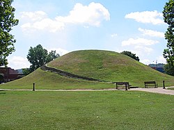
South Charleston is a city in Kanawha County, West Virginia, United States. It is located to the west of the state capital of Charleston. The population was 13,639 at the 2020 census.[2] It was established in 1906, but not incorporated until 1917.[4] The Criel Mound built circa 0 BCE by the Adena culture is adjacent to the city's downtown business district.
It is home to the Charleston Ordnance Center, a former naval munitions factory established for use in World War I.
The city is serviced by Interstate 64, U.S. Route 60, U.S. Route 119, West Virginia Route 601 and West Virginia Route 214, and is adjacent to the Kanawha River. The city is serviced by the Kanawha Valley Regional Transportation Authority bus system. A general aviation airfield, Mallory Airport, is located off Chestnut Street, approximately two miles south of U.S. Route 60, with the nearest commercial aviation service being at Yeager Airport in Charleston. South Charleston serves as the headquarters to the West Virginia Division of Natural Resources and the West Virginia State Police.
- ^ "2019 U.S. Gazetteer Files". United States Census Bureau. Retrieved August 7, 2020.
- ^ a b c "City and Town Population Totals: 2020-2021". Census.gov. US Census Bureau. Retrieved July 3, 2022.
- ^ "US Board on Geographic Names". United States Geological Survey. October 2, 2007. Retrieved January 31, 2008.
- ^ Cite error: The named reference
SCMainwas invoked but never defined (see the help page).

