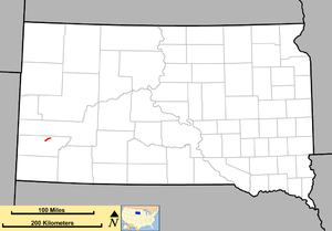
 Route of SD 36 (in red) | ||||
| Route information | ||||
| Maintained by SDDOT | ||||
| Length | 9.087 mi[1] (14.624 km) | |||
| Existed | 1926–present | |||
| Major junctions | ||||
| West end | ||||
| East end | ||||
| Location | ||||
| Country | United States | |||
| State | South Dakota | |||
| Counties | Custer | |||
| Highway system | ||||
| ||||
| ||||
South Dakota Highway 36 (SD 36) is an east–west state route located in southwest South Dakota. It begins at the junction of U.S. Route 16A on the eastern edge of Custer State Park, and ends at South Dakota Highway 79 just south of Hermosa. It is slightly over nine miles (14 km) in length.
- ^ "State Highway Log" (PDF). Rapid City region: South Dakota Department of Transportation. January 2011. p. 70. Retrieved December 24, 2011.
